Wet-Boot Adventure in Paria Canyon AZ
Richard Rathe, 2024 (Camping, Photography)
The Paria River begins up by Bryce Canyon and flows south through Grand Staircase Escalante and the Vermilion Cliffs Arizona. Just before it empties into the Colorado River it flows thru a deep slot canyon and this is where we hiked. This was by far the most technically challenging backpacking trip I've ever attempted!
Day 1

We delayed our departure by a day to avoid some rain & snow, but that same precip made the river rise—and our travel more difficult. We actually started in the early afternoon as the rain clouds were moving out. We planned a short first day to let us get used to our packs and the unusual trail conditions. The water temperature was in the 40s by my guess. Our footwear and neoprene socks worked well for this, but occasionally we had water above the knee.

We found one groups of petroglyphs along the way. (There were supposed to be two more, but we did not have time to search them out.) These were big horn sheep and geometric shapes on a huge overhanging wall, faint, mostly eroded by time.

The first night we camped by a huge cottonwood tree (The only tree of any size in the entire valley.) It was a great site! We made a trail dinner, got in our tents, and slept well. It was frosty the next morning!

(click any image to view or advance)


Day 2
The next day the canyon closed in. We crossed the river many times and were making less than a mile per hour. It wasn't particularly hard hiking, just very time consuming. We enjoyed every minute of it!


It was a gorgeous hike, but we had to stop short of the next campsite due to waist high water (remember that earlier rain!). It was cold (30s) and getting colder (17° F the next night). We were not prepared to be that wet!

This left us deep in the canyon with no obvious way to hike out before dark. We backtracked to a wide shelf and bivouaced there because it had a large side crack we could climb up 30 feet if the river rose unexpectedly. (The river had actually gone down a foot by then, and we knew no new rain was expected. We did place several sticks at the waterline to help determine if the water was rising.) We had a nice hot Thanksgiving dinner and a comfortable night.
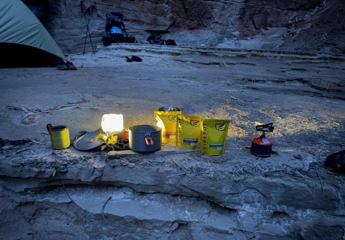
(click any image to view or advance)


Day 3
I took this #360_panorama the next morning.
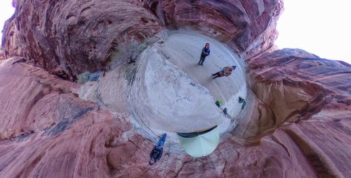
The river runs from top-center to top-right (above our heads). Peter and I are standing on the lower shelf, our tents are off to the right under an alcove. Al is standing on the upper shelf (about 4 feet higher) with his tent. Our flood escape route was the large opening to the left.

On our return hike it actually got colder. My feet felt warmer in the river, not out! By the afternoon there was ice forming on the river edges that were in the shade.
Got to the car before dark and grabbed a very nice walk-in campsite at the trailhead. Then it got really cold!
(click any image to view or advance)


Day 4 (Trailhead)
The BLM campground at the trailhead has several walk-in sites that are quite nice. I slept out under the stars and just barely kept warm enough. In the morning we found out that temps in the general area were down in the teens! (A fellow camper said he measured 17 degrees overnight.) There was frost everywhere. This trip was at the limit of our equipment so we took a great day hike and slept comfortably in a motel that night.

